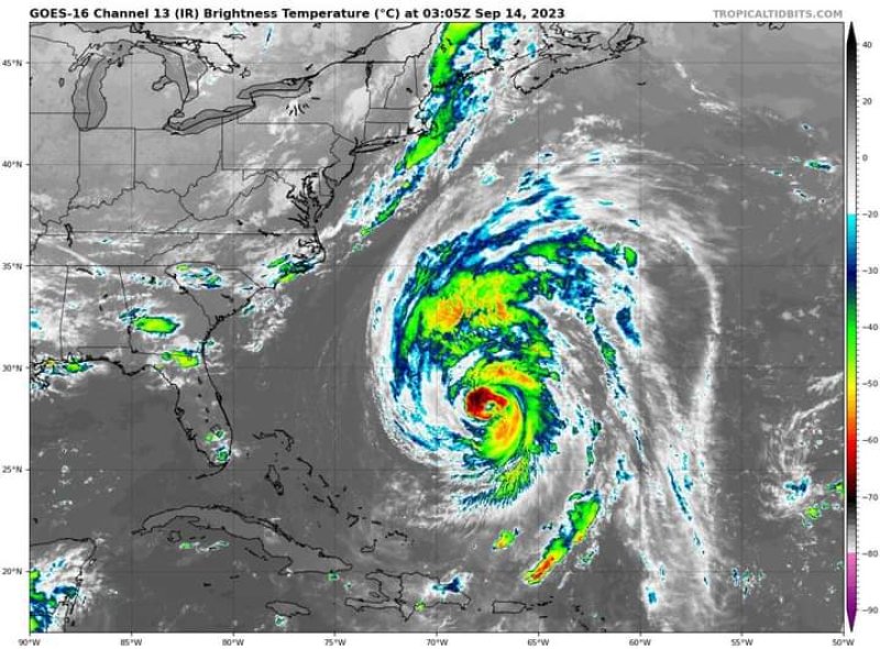
Hurricane Lee continues churn towards east coast of US and Canada

Hurricane Lee turned north on Wednesday and is forecast to grow larger as it travels, becoming a huge hurricane off the New England shore by Friday night.
Lee currently has sustained winds of 110 mph (175 km/h), according to the US National Hurricane Center (NHC).
Residents in coastal Canada have also been warned to brace for the storm.
"Slow weakening is forecast during the next few days, however, Lee is likely to remain a large and dangerous hurricane into the weekend," the NHC said in an advisory on Wednesday.
Forecasters say that, due to Lee's large size, areas far from the hurricane's centre could feel its effects.
Lee dropped to a category two hurricane on Wednesday. Hurricane force winds can be felt 115 miles (185km) from it's centre, while tropical storm force winds extend outward up to 240 miles.
Already, Lee is "producing dangerous surf and rip currents" on the southeastern US coast, said the US National Weather Service (NWS).
Hurricane and tropical storm watches have been issued for the entire coastlines of Rhode Island, Massachusetts, New Hampshire and much of Maine.
Bermuda was placed under a tropical storm warning earlier on Wednesday.
Lee, which formed in the first week of September, is expected to lash states that have already seen above average rainfall over the past month.
Massachusetts Governor Maura Healey declared a state of emergency on Tuesday night after flash floods washed out roads, created sinkholes and destroyed buildings in parts of the state.
Experts also warn that the hurricane may topple trees.
"Slow weakening is forecast during the next few days, however, Lee is likely to remain a large and dangerous hurricane into the weekend," the NHC said in an advisory on Wednesday.
Forecasters say that, due to Lee's large size, areas far from the hurricane's centre could feel its effects.
Lee dropped to a category two hurricane on Wednesday. Hurricane force winds can be felt 115 miles (185km) from it's centre, while tropical storm force winds extend outward up to 240 miles.
Already, Lee is "producing dangerous surf and rip currents" on the southeastern US coast, said the US National Weather Service (NWS).
Hurricane and tropical storm watches have been issued for the entire coastlines of Rhode Island, Massachusetts, New Hampshire and much of Maine.
Bermuda was placed under a tropical storm warning earlier on Wednesday.
Lee, which formed in the first week of September, is expected to lash states that have already seen above average rainfall over the past month.
Massachusetts Governor Maura Healey declared a state of emergency on Tuesday night after flash floods washed out roads, created sinkholes and destroyed buildings in parts of the state.
Experts also warn that the hurricane may topple trees. BBC News


