


Look no further than ASEAN's 2024 administrative arrangement with the EU on humanitarian affairs. The agreement has helped advance joint training, increased bloc exposure to disaster management best practices, and helped direct the EU's multimodal satellite assistance to ASEAN member states, including Myanmar this year. With Indonesia and Thailand witnessing a 134% increase in flood related disasters since 2000, integrating their early assessment needs into the agreement is critical. Nikkei Asia reported.
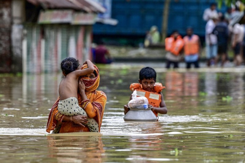
Bangkok's partnership and cooperation agreement with the bloc has been a key point of focus on climate change since around 2022. Yet, the evolution of climate cooperation into timely, event-specific satellite imagery support has not materialized. Thailand could provide incentives to the United Nations to boost satellite imagery support to cater to the 4 million people affected by floods. But it is unclear if these incentives, including support to accelerate critical emergency grants from the Asian Development Bank, would afford rapid satellite monitoring capacities in the heat of the current crisis.
With these constraints in mind, dedicated external support to guard against extreme weather events remains vital. The EU's track record of providing similar, low-cost satellite monitoring capacities as far as Africa, Europe and Latin America make it a time-tested and dependable source of satellite imagery to inform high-precision monitoring.
Interestingly, accelerated early warning system access could emerge as a strong incentive once ASEAN's existing framework on an end-to-end early warning system is supplemented with the EU's satellite mapping. This would fill a critical gap in the disaster assessment so far in Indonesia and Thailand: having satellite mapping coverage that allows the extent of damage to be compared to other parts of the world.
For instance, the triggers behind flash floods, such as those witnessed in Morocco's Safi coastal region, can be communicated in real time. This can be done through the EU's monitoring system, which has the potential to shape contingency measures coordinated by international relief organizations.
Look no further than the Global Disaster Awareness and Coordination System, a joint disaster management framework that the EU has used to integrate cutting-edge satellite mapping into the disaster response plans of international relief organizations. Given the outsized importance of international assistance in shaping the effective response options of Indonesia and Thailand, stronger coordination of relief organizations' priorities will help time search and relief operations, climate-resilient infrastructure funding, and displacement support operations in an efficient manner.
"For all isolated areas, even though hundreds of items of logistics have been sent [by air], we still have to send more because air transport's delivery capacity is limited," Indonesia's National Disaster Mitigation Agency chief Lt. Gen. Suharyanto said recently.
These gaps reinforce the value of an integrated response mechanism that builds on the strengths of the EU, and can be tailored to the search and rescue operations and satellite imagery needs of Indonesia and Thailand. With reconstruction costs in billions and floods disrupting life for millions of households, the call to action couldn't be clearer.