


According to the forecast issued at 5.30 a.m., Western, Sabaragamuwa, Central, North-western, Northern and North Central provinces, along with Galle, Matara and Trincomalee districts, will experience showers or thundershowers at times. Fairly heavy rainfall exceeding 75 mm is expected in certain locations within these areas. Other regions of the country will likely experience showers after 1.00 p.m.
Strong winds between 40-50 kmph may occur periodically over the western slopes of the central hills and in Western, Northern, North-central, North-western and Southern provinces, as well as in the Trincomalee district. The public is urged to take necessary precautions to minimize damage from localized strong winds and lightning.
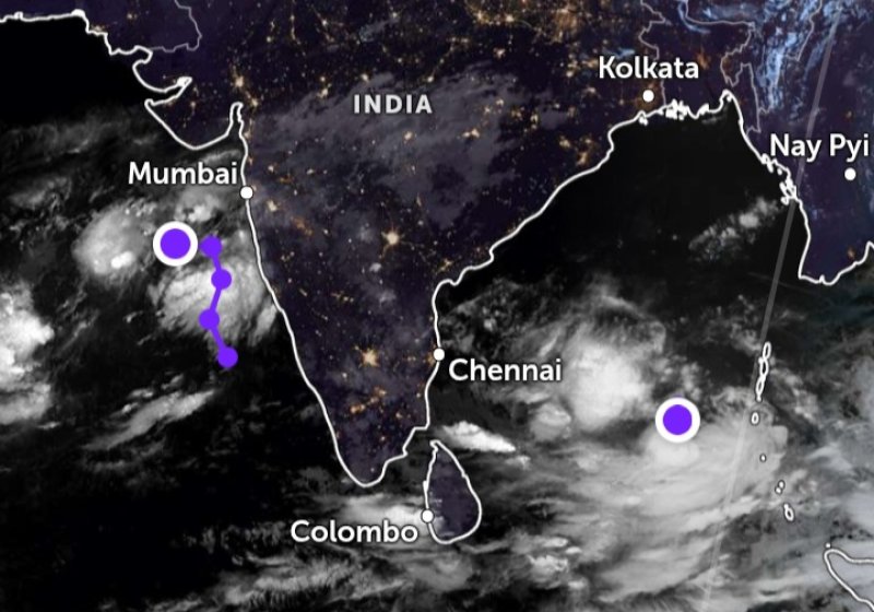
Meanwhile, naval and fishing communities are advised to remain highly vigilant, as the low-pressure area located approximately 850 km northeast of Batticaloa is expected to develop into a depression today (25), intensify into a deep depression by October 26, and further strengthen into a cyclonic storm by October 27.
Sea areas around the island, particularly from Kankasanthurai to Batticaloa via Trincomalee and from Galle to Pottuvil via Hambantota, are expected to turn fairly rough to rough at times with wind speeds rising up to 60 kmph. Showers or thundershowers are likely in these sea regions at intervals, with the possibility of very rough seas during thunderstorms.
The Met Department advises all maritime and coastal communities to follow safety guidance and stay updated on further weather developments.