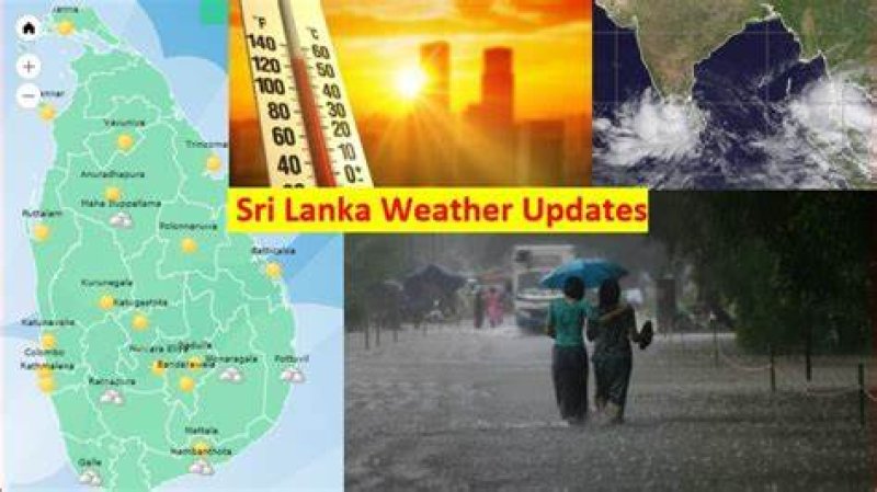
Showers or thundershowers will occur at times in Western, Sabaragamuwa, Southern, Central and North-western provinces. Fairly heavy showers above 50mm are likely at some places in Western and Sabaragamuwa provinces and in Galle, Matara and Nuwara-eliya districts.
WEATHER FORECAST FOR 05 September 2023
Issued at 12.00 noon on 04 September 2023A few showers are likely in Jaffna, Mannar and Anuradhapura districts.
Fairly strong winds about (40-45) kmph can be expected at times in western slopes of the central hills, Western, Southern, North-western, Northern and North-central provinces.
On the apparent southward relative motion of the sun, it is going to be directly over the latitudes of Sri Lanka during 28th of August to 07th of September in this year. The nearest towns of Sri Lanka over which the sun is overhead tomorrow are Bambalapitiya, Maliboda, Keppetipola, Badalkumbura and Pottuvil about 12.09 noon.
LAST 24 HOURS

Max. Temperature 34.6°C
Polonnaruwa

Min. Temperature 13.5°C
Nuwara Eliya

Max. Rainfall 115.0mm
Kukule ganga (kalutara)
Sea Area around Sri Lanka
WEATHER FORECAST FOR SEA AREAS AROUND THE ISLAND DURING NEXT 24 HOURS
Issued at 12.00 noon on 04 September 2023
| Condition of Rain: | ||||||
| Showers or thundershowers will occur at times in the sea areas off the coast extending from Puttalam to Hambantota via Colombo, Galle and Matara. | ||||||
| Winds: | ||||||
Winds will be south-westerly and speed will be (30-40) kmph. Wind speed may increase up to (60-70) kmph at times in the sea areas off the coast extending from Hambantota to Pottuvil and in the sea areas off the coast extending from Puttalam to Trincomalee via Mannar and Kankasanthurai. Wind speed may increase up to (50-60) kmph at times in the sea areas off the coast extending from Puttalam to Hambantota via Colombo and Galle. | ||||||
| State of Sea: | ||||||
The sea areas off the coast extending from Hambantota to Pottuvil and in the sea areas off the coast extending from Puttalam to Trincomalee via Mannar and Kankasanthurai can be very rough at times. The sea areas off the coast extending from Puttalam to Hambantota via Colombo and Galle can be rough at times. Temporarily strong gusty winds and very rough seas can be expected during thundershowers. Multi-day Boats ForecastWEATHER FORECAST FOR MULTI-DAY BOATS For the sea areas in between 20N - 10S and 60E-100E (Issued at 07.00 a.m. on 04 September 2023, for next 24hours) Sea areas around the Island
Bay of Bengal Weather: EQ-20N, 90E-100E : Showers or thundershowers at most places. 10N-20N, 80E-90E : Showers or thundershowers at most places. Other sea areas : Showers or thundershowers at several places. Winds: 03N-17N, 80E-100E : South-westerly / (30-40) kmph, gusting up to (60-70) kmph. Other sea areas : South-westerly / (30-40) kmph. State of the Sea: 03N– 17N, 80E-100E: Rough, very rough at times. Other sea areas : Moderate to fairly rough. Arabian Sea Weather: 05N-15N, 65E-80E : Showers or thundershowers at several places. Other sea areas : Showers or thundershowers at few places. Winds: EQ-10N, 73E-80E : Westerly to South-westerly / (30-40) kmph, gusting up to (50-55) kmph. 10N-17N, 60E-65E : South-westerly / (30-40) kmph, gusting up to 50kmph. Other sea areas : South-westerly to Westerly / (20-30) kmph. State of the Sea EQ-10N, 73E-80E: Fairly rough, rough at times. 10N-17N, 60E-65E : Fairly rough. Other sea areas : Slight to moderate. South Indian Ocean: Weather: EQ-05S, 75E-90E : Showers or thundershowers at Several places. 02S-10S, 60E-75E : Showers or thundershowers at several places. Other sea areas : Showers or thundershowers at few places. Winds: 05S-10S, 60E-100E : South-easterly/ (30-40) kmph, gusting up to (50-55)kmph. Other sea areas : South-easterly / (30-40) kmph. State of the Sea: 05S-10S, 60E-100E : Fairly rough, rough at times. Other sea areas : Moderate to fairly rough.
**Temporary strong gusty winds and rough seas can be expected during thundershowers. Duty-Meteorologist Department of Meteorology |