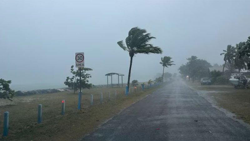
Tropical Cyclone Grant is expected to pass close to Cocos (Keeling) Islands from this evening, bringing heavy rainfall and damaging winds.
It comes as much of WA swelters through a heatwave, with the Christmas Day temperature in Perth set for 40C.
Preparations are underway far off Western Australia's north-west coast for the impact of a category one cyclone as Perth and much of the state continues to swelter in heatwave conditions.
Tropical Cyclone Grant formed on Tuesday morning in the Indian Ocean, east of the Cocos (Keeling) Islands, and could cause large waves, flash flooding and wind gusts of up to 100 kilometres per hour.
The system is moving in a west-north-westerly direction at around 8 kilometres per hour, and is expected to pass close to the Islands late on Christmas Eve or early Christmas Day.
he Bureau of Meteorology (BOM) has warned the cyclone could strengthen to a category two by this evening.
BOM duty forecaster Helen Reid warned residents of the islands, which is home to around 600 people, to prepare for strong winds and flooding, with the system set to make its presence felt from today.
"We are expecting it to travel to the north of the Island rather than right across the island, but given it's just such a small spot in the size of a large ocean, it will be very close to the island there," she said.
"We do need to be aware of those winds getting up to around 40 knots over the night tonight, and also those seas and swells getting up to around two to four metres.
"There will be plenty of rainfall, lots of flash flooding as well and the chance of a thunderstorm, and we are expecting that westward track to continue into tomorrow and away from the Island during the course of Christmas Day itself."
The BOM said while there was no immediate danger, residents should be prepared and keep up to date with advice.
A low pressure trough is not only bringing hot conditions with it, but is likely to generate dry and gusty thunderstorms for areas along the west coast.
The weather bureau has updated the Christmas Day forecast for Perth, with thunderstorms now a possibility in the afternoon and early evening.
A low pressure trough is not only bringing hot conditions with it, but is likely to generate dry and gusty thunderstorms for areas along the west coast.
The weather bureau has updated the Christmas Day forecast for Perth, with thunderstorms now a possibility in the afternoon and early evening.
A three-day heatwave warning is in place for much of the WA coastal and north interior regions between December 23 and Boxing Day.
Perth is set to reach 40 degrees Celsius on Christmas Day, and overnight temperatures around the state will be in the mid to high-20s.
Day-time temperatures will be up to 15 degrees above average in the far south-west, and about 10 degrees warmer than usual for places like the metro area.
If the overnight temperature in Perth stays above 26 degrees, it could break a century-old Christmas record for the city.
Perth's warmest Christmas morning on record dates back to 1915, when the minimum only dropped to 25.9 degrees.
The hot temperatures combined with strong winds mean high and extreme fire danger ratings blanket much of WA on Christmas Eve and Christmas Day.
Total fire bans are in place on Christmas Eve from Perth's Swan Valley region all the way up to Kalbarri in the Midwest.