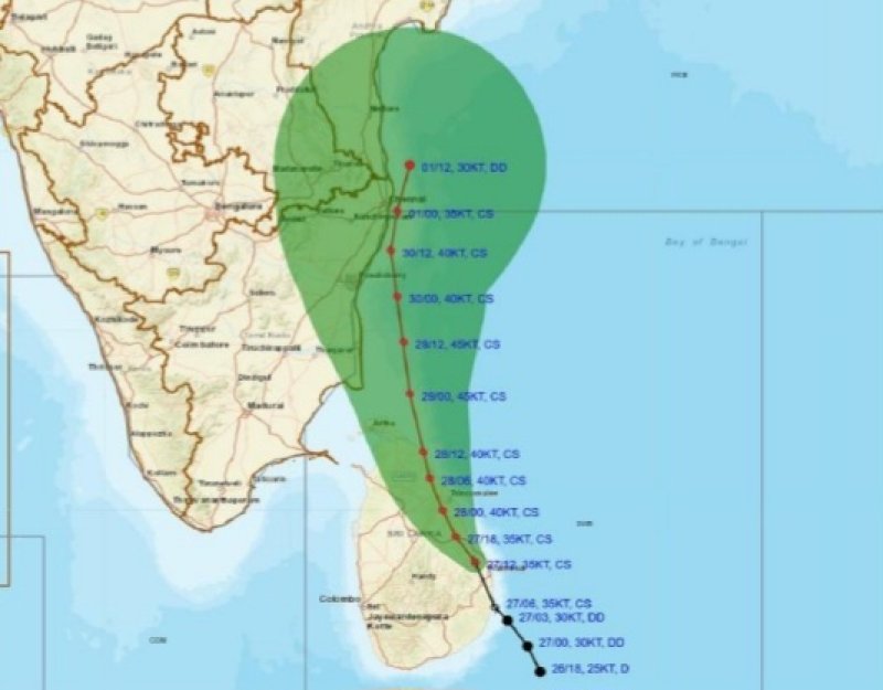
The Cyclonic Storm “Ditwah” [Pronunciation: Ditwah] is centered near latitude 8.5°N and longitude 81.0°E, about 30km Southwest of Trincomalee. It is very likely to move north-northwestwards. (Cyclone track details attached.)
Due to the influence of the above system very strong winds at times about (60-70) kmph and gusting up to (80-90) kmph can be expected over the sea areas around the island and the sea areas can be very rough at times.
Very heavy showers or thundershowers are likely in sea areas around the island. The swell waves (about 3.0-4.0 m) height may increase in the sea areas around the island. The near shore sea areas may experience surges as well.
Action suggested for the Land area:
Naval and fishing communities are advised not to venture in to the sea areas around the island, until further notice.
General public is requested to be vigilant regarding impending extreme weather situation until November 30th.
For emergency assistance contact the local disaster management authorities.
Requested to be attentive about future advisories issued by the Department of Meteorology in this regard.